Skip to main content
Interactive Map – Zoom in on a satellite view of the Selected Alternative from the Record of Decision and Final Preliminary Section 4(f) Evaluation.
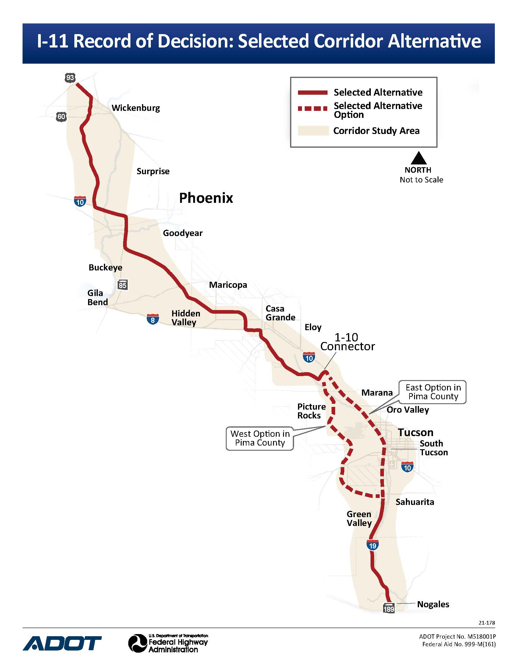
Study AreaThe I-11 corridor study area stretches 280 miles from Nogales to Wickenburg, Arizona. The corridor study area varies in width from approximately 10 to 25 miles.
Interactive MapThe Interactive Map shows the Selected Corridor Alternative from the Final Tier 1, as well as the Recommended Alternative from the Record of Decision. Select the icons on the left side of the map to use the zoom function, change the base map, view the legend, and show or hide map layers. You can also use the search tool on the right to find an address or location.
Corridor AlignmentFor reference, a corridor is a 2,000-foot-wide swath of land. An ultimate freeway alignment is approximately 400 feet or less and its specific location would be determined during Tier 2 environmental studies. Tier 2 studies have not been funded or programmed yet.
Map illustrates the Selected Alternative from the Tier 1 EIS Record of Decision.